June 15, 2026. — It’s official: El Niño is back. By late fall 2026, forecast models give a 2-in-3 chance of a strong-to-very strong El Niño affecting the weather, climate and ocean temperatures across the planet.
El Niño is the climate system’s biggest player and one side of the El Niño-Southern Oscillation, or ENSO. It’s the heads to La Niña’s tails.
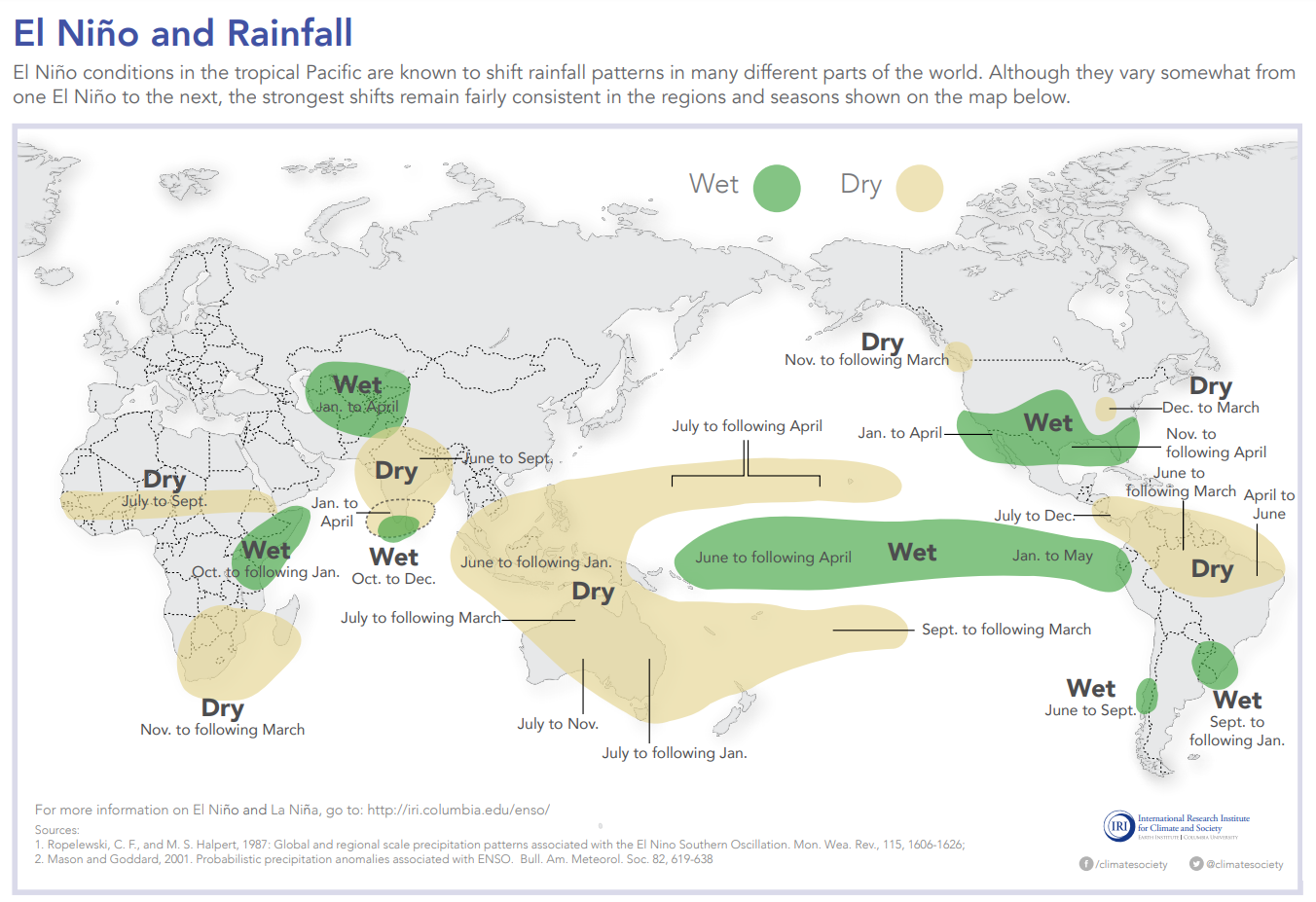
During El Niño, a swath of ocean stretching 6,000 miles (about 10,000 kilometers) westward off the coast of Ecuador warms for months on end, typically by 2 to 4 degrees Fahrenheit (about 1 to 2 degrees Celsius). A few degrees may not seem like much, but in that part of the world, it’s more than enough to completely reorganize wind, rainfall and temperature patterns all over the planet.
I’m a climate scientist who studies the oceans. With an El Niño expected to strengthen through the summer and fall, water temperatures will heat up even more. It’s time to start preparing.
How does El Niño affect the planet?
No two El Niño events are exactly alike, though we’ve seen enough of them that forecasters have a pretty good idea of what’s likely to happen.
People tend to focus on El Niño’s impact on land, justifiably. The warm water affects air currents that leave areas wetter or drier than usual. It can ramp up storms in some areas, like the southern U.S., while tending to tamp down Atlantic hurricane activity.
El Niño can also wreak havoc on the many marine ecosystems that support the world’s fishing industries, including coral reefs and seagrass meadows.
Specifically, El Niño tends to trigger intense and widespread periods of extreme ocean warming known as marine heat waves.
Global ocean temperatures are already near record highs, so El Niño-induced marine heat waves could push many sensitive fisheries to a breaking point.